On the AT50-09 expedition, we will be mapping margins of the Galápagos Platform that have never been explored in detail.
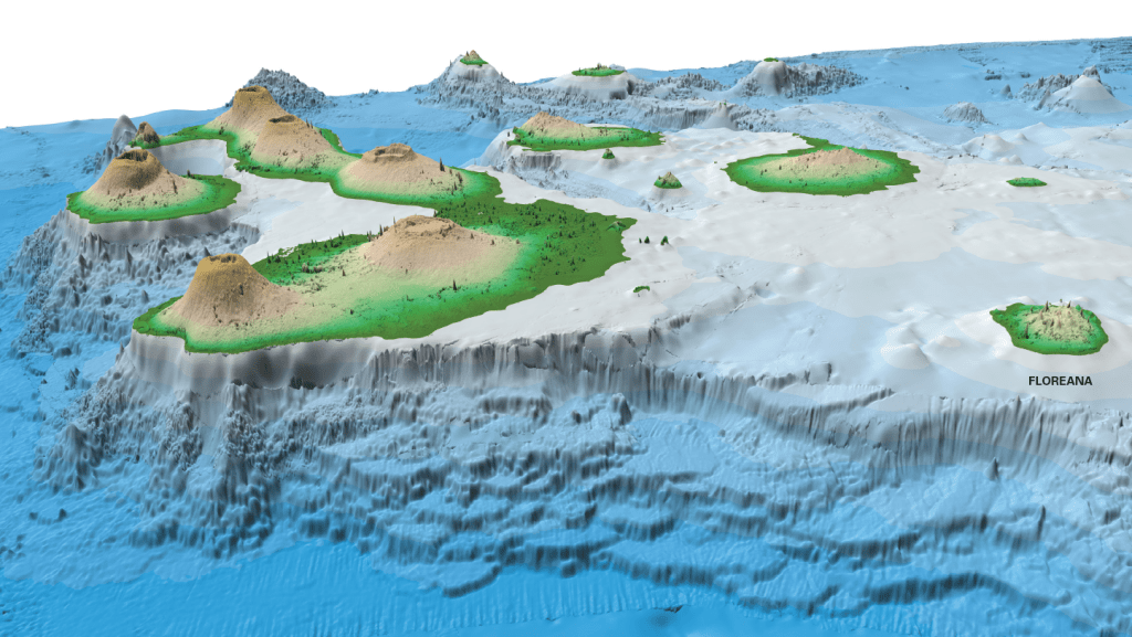
The Galápagos Islands are considered to be an archipelago, or group of islands, that comprises numerous volcanoes that formed as a result of “hotspot volcanism”. “Hotspots” occur in Earth’s mantle. Hotspots are places where magma (molten rock) is generated in the middle of tectonic plates away from plate boundaries. Other hotspot volcanic island chains include Hawaii and the Azores.
The Galápagos Archipelago is unique compared to these examples because it is positioned atop a broad submarine platform that rises more than 3000 meters above the surrounding seafloor; this is nearly twice the height of the Grand Canyon (Figure 1).
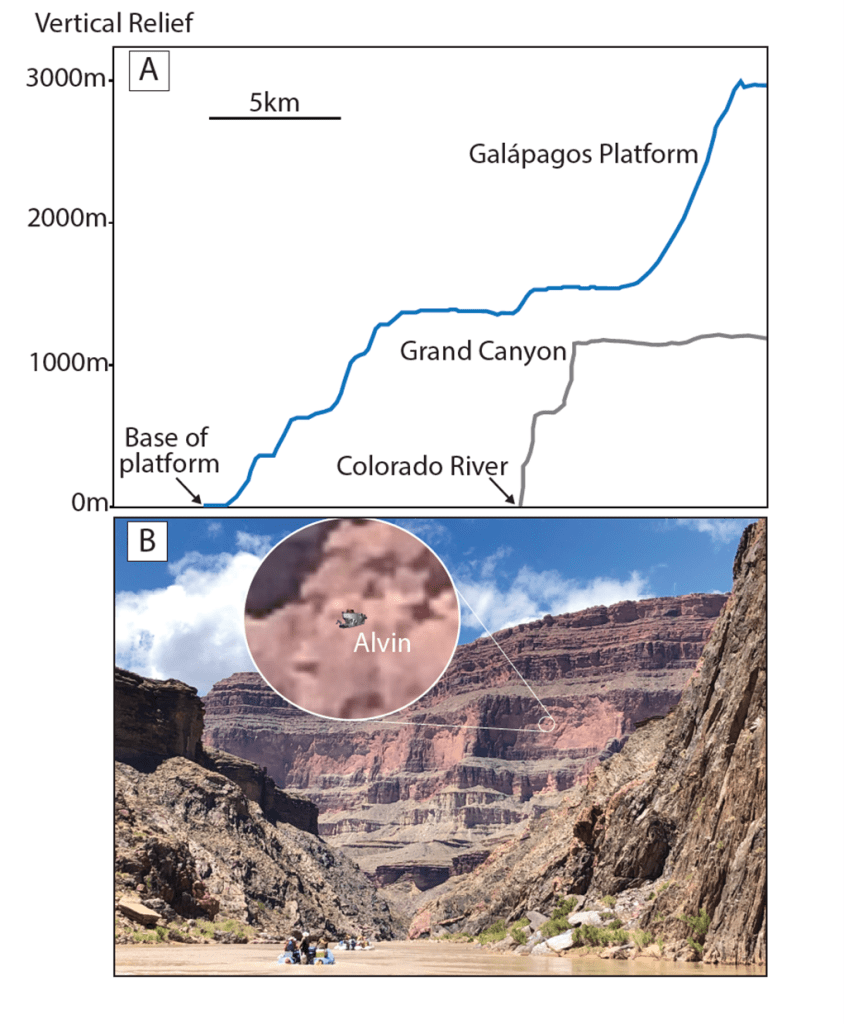
the Grand Canyon. B) Photograph of a wall of the Grand Canyon taken from
the Colorado River (Photo Credit: James Hagadorn of the Denver Museum of
Natural Science and Mike Mohr at Boise State University). Alvin has been
superimposed onto the photograph for scale and a magnification of that
superposition is provided for detailed reference.
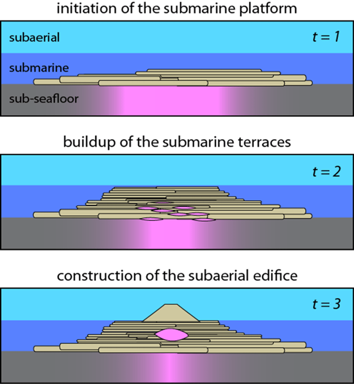
Previous mapping and remote sample collection on the relatively young western and southern margins of the Galápagos Platform (Figure 2) have led to the hypothesis that the platform is constructed by the stacking of large area submarine lava flows (Figure 3). Despite its huge volume and importance in understanding how the Galápagos Islands are formed, the Galápagos Platform remains largely unexplored and its origin poorly understood.
Additionally, it remains unclear how platform volcanism relates to the construction of subaerial volcanoes that make up the islands in the Galápagos over space and time. Are the volcanoes built on top of the Platform, or do the volcanoes grow first, and then surrounded by younger Platform lavas?

basket of a successful dredge of the Galápagos Platform aboard the R/V
Revelle as a part of the DRIFT04 expedition in 2001. Fernandina and
Isabela Islands are discernible in the background (Photo Credit: Dennis
Geist).
If the terrace hypothesis is correct and applicable to the older portions of the archipelago, we expect that our new high-resolution maps of the seafloor will capture the presence and extent of platform forming lava flows. We will use Alvin to make direct observations of these lava formations for the first time and collect in-situ lava samples from these newly mapped locations.
Following the expedition, we will analyze the rocks that we have collected for their chemistry, which can be used to relate Platform lavas to the other areas that have already been sampled using dredging (Figure 2) and a very few ROV dives, and to the extensively studied volcanic islands in the archipelago.
The results of this research will help us to better understand the constructional volcanic history of the Galápagos Platform and archipelago as a whole.
As well as collecting samples from the platform, we will be using multibeam technology onboard the R/V Atlantis to collect improved maps of the Galápagos Platform seafloor. Only around 25% of our global seafloor has been mapped in sufficient detail, and only sections of the Galápagos Platform have been mapped. We will map seafloor never mapped before, and also remap over areas were bathymetric maps were collected in the past few decades, as multibeam technology has improved over the years.
If you want to learn more about seafloor mapping, this is a very helpful article from our onboard scientist Shannon Hoy.

Leave a comment